Science of Climate Change
Climate change is the long-term shift in average weather conditions. Anthropogenic climate change (observed changes in Earth’s atmosphere since the mid-20th century) refers to recent human-caused shifts in global climate patterns.
Why is Earth’s Climate Changing?
Our climate has always fluctuated based on ocean patterns, volcanic activity, changes in the Earth’s orbit, and variations in the Sun’s energy. Since the start of the industrial revolution, the combustion of fossil fuels (e.g., coal, gas, and oil) have resulted in tremendous amounts of carbon dioxide (CO2) and other greenhouse gases (GHGs) accumulating in Earth's atmosphere. GHGs are responsible for the natural greenhouse effect, which traps heat at the surface and is essential for life. However, the volume of GHGs that have been emitted by human activity since the late 18th century has dramatically enhanced the atmosphere's natural greenhouse effect. Today, global CO2 levels are higher than at any time in the last 800,000 years.

Left - Naturally occurring greenhouse gases—carbon dioxide (CO2), methane (CH4), and nitrous oxide (N2O)—normally trap some of the sun’s heat, keeping the planet from freezing.
Right - Human activities, such as the burning of fossil fuels, are increasing greenhouse gas levels, leading to an enhanced greenhouse effect. The result is global warming and unprecedented rates of climate change.
Today’s high levels of GHGs are “turning up the thermostat” on Earth’s atmosphere to a point where global climate patterns are rapidly shifting. Changes in surface temperature, sea levels, and precipitation patterns threaten life and property. If nothing is done to slow and eventually halt anthropogenic GHG emissions, Earth’s climate will continue to swiftly change.
Read more about the causes of climate change

Climate Change Impacts in Rhode Island
The impacts of climate change in Rhode Island are diverse, documented, and increasingly severe. Climate change has the potential to pose significant risks to Rhode Island’s natural and built environment. The public health, welfare, and economic well-being of residents and businesses will be impacted directly or indirectly by changing climate conditions. The following impacts are the six manifestations of climate change in Rhode Island from the Resilient Rhody State of Resilience Report - 2024.
- The historic rate of sea level rise from 1930 to 2023 is 2.92 mm/year, or over 1” per decade. In other words, sea level has risen nearly 11” in Rhode Island since 1930. Citation.
- Global mean sea level rise since 1993 has accelerated to 3.5 mm/year (satellite altimetry). Citation.
- The mean annual rate of sea level rise in Newport was 4.25 mm/year from 1986-2022. Citation.
- In February 2022, the National Oceanic and Atmospheric Administration (NOAA) projected high sea level rise scenarios for the Northeast at 1.77 feet by 2050, 6.89 feet by 2100, and 12.14 feet by 2150 (measured from the year 2000). Citation.
- Coastal inundation levels and storm surge impacts will increase due to sea level rise. Citation.
- With a 2°C temperature increase above pre-industrial levels, rainfall rates within tropical storms and hurricanes are projected to increase by about 14%. Citation.
- Globally, tropical cyclone intensities are projected to increase by 1 to 10%, according to projections for 2°C global warming. The proportion of tropical cyclones that reach very intense (Category 4 and 5) levels is projected to increase due to anthropogenic warming over the 21st century. Citation.
- Climate change is projected to magnify the impact of tropical cyclones in the U.S. Northeast through increased rainfall and wind speed. The coastal region at severe risk from tropical storms is projected to expand northward within the US Northeast. Citation.
- Annual economic damage from U.S. landfalling hurricanes has increased remarkably since 1900. Studies agree that the dominant driver of the increase has been the rise in the amount and economic value of built infrastructure and wealth along the U.S. coast in hurricane-prone regions. Citation.
- The Northeast has experienced the largest national increase in the number of extreme precipitation days (the top 1% of heaviest precipitation events), with an increase of 60% from 1958 to 2021. The region’s annual and 5-year maximum precipitation amounts have also increased by over 10%. Citation.
- In New England, extreme precipitation days have increased 71% from 1901-2012. Citation.
- There is robust evidence that warming caused by humans has contributed to increases in the frequency and severity of the heaviest precipitation events across nearly 70% of the US. Citation.
- Studies project that the observed increase in heavy precipitation events will continue in the future. Under the higher scenario (RCP8.5) the number of extreme events (exceeding a 5-year return period) increases by two to three times the historical average in every region by the end of the 21st century, with the largest increases in the Northeast. Under the lower scenario (RCP4.5), increases are 50%–100%. Citation.
- Additional Impact: Five of the top 10 wettest years in Rhode Island have occurred since 2000, with 2023 recording 57.66” of precipitation, the sixth highest annual amount since 1904. Source.
- Additional Impact: Since 1904, the Providence area has observed a slight increase in annual snowfall because some of the state's largest snowstorms have occurred since 2000. This is attributed to more water vapor in the atmosphere, a product of warmer ocean temperatures due to climate change. The years 2015 and 2005 the second and third snowiest years on record, respectively. However, annual snowfall is projected to decrease as air temperatures continue to warm due to climate change. Source.
- Levels of CO2 have surpassed 420 parts per million (ppm), well above the pre-industrial (1850) level of 280 ppm. Citation.
- The Paris Agreement set the target of holding global average temperature below 2°C above pre-industrial levels and pursuing efforts to limit the temperature increase to 1.5°C above pre-industrial levels. Current global averages are 1.35°C degrees above pre-industrial levels. Citation.
- 2023 is, to date, the warmest year on record. Citation.
- In 2020, Rhode Island experienced 23 days above 90°F and three heat waves, creating severe drought across 43% of the state. In 2022, Rhode Island experienced the fourth-hottest July on record and the hottest August on record, with a combined 16 days above 90°F and two heat waves, leading to an extreme hydrologic drought that left Providence declared as a federal disaster area. Citations: (1), (2), and (3).
- Additional Impact: Winter temperatures are rising faster than summer temperatures, likely attributed to a warmer North Atlantic Ocean. Notably, Rhode Island’s three warmest winters have all occurred since 2000, while the three coldest winters all occurred before 1980. Source.
- From 1901 through 2023, sea surface temperature rose at an average rate of 0.14°F per decade globally. Citation.
- Ocean temperatures in the continental shelf bottom waters of the Northeast have increased by 0.15°F to 0.7°F per decade. Citation.
- Over the 50 year span from 1960 to 2010, the surface temperature of the Bay increased between 1.4° to 1.6°C (2.5° to 2.9 °F). Winter water temperatures in the Bay increased even more, between 1.6° to 2.0 °C (2.9° to 3.6 °F). Citation.
- From 2003-2019, temperatures at the surface and bottom of Narragansett Bay increased at rates of 0.02°C (0.04°F) per year and 0.04°C (0.07°F) per year, respectively. Over these 16 years, surface temperature increased 0.32°C (0.58°F) and bottom temperature increased by 0.64°C (1.15°F). Citation.
- In Rhode Island, spring is arriving sooner, with plants leafing out approximately two weeks earlier than the 1991-2020 average. According to 24 years of weather radar data, spring migrants are likely to pass certain stops earlier now than they would have 20 years ago. Citation.
- Total statewide losses of existing coastal wetlands are predicted to be 13%, 52% and 87% under 1, 3 and 5 feet sea level rise (SLR) scenarios, respectively. Citation.
- Since the 1980s, fish communities have changed, with warm-water species (scup and butterfish) displacing cool-water resident species (winter flounder and red hake). In the Northeast, warming water is changing the distribution of bottom-dwelling species, including American lobster, Atlantic surf clams, and sea scallops. Citations: (1) and (2).
- Globally, algal blooms have increased in size by about 13 percent, or 1.5 million additional square miles, and have increased in frequency by 59 percent. Citation.
Interested in Learning More?
The Rhode Island Executive Climate Change Coordinating Council (EC4) and its member agencies are committed to scientifically evaluating the effects of climate change. To learn more, check out the following resources that highlight the effects of climate change in Rhode Island. Visit the Resilient Rhody page to learn about solutions to climate change impacts in the state.

Current State of Climate Science in Rhode Island
Read about the EC4’s Science and Technical Advisory Board (STAB) synopsis on the state of knowledge of climate science. The Current State of Climate Science in Rhode Island further details the science behind sea level rise, changes in air and water temperature, storm frequency and intensity, biodiversity, and precipitation patterns.
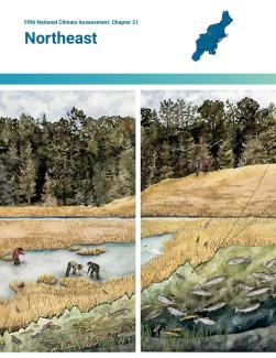
Fifth National Climate Assessment: Northeast
The Fifth National Climate Assessment: Northeast highlights the ways in which New England and the mid-Atlantic states are currently experiencing the harmful effects of climate change. This report, published by the U.S. Global Change Research Program in November 2023, assesses climate risks and describes challenges, opportunities, and success stories for managing risks. Explore the complete Fifth National Climate Assessment.

NOAA 2022 Rhode Island State Climate Summary
The National Oceanic and Atmospheric Administration’s (NOAA) National Centers for Environmental Information state-level climate summary for Rhode Island highlights historical climate variations, future climate model predictions of climate conditions during the 21st century, and past and future conditions of sea level and costal flooding.
Click Here to Learn More